
During its vacation week, the Nice Premium team is pleased to offer you a compilation of its best articles. For this last day, you will find a selection of five articles by the editors.
 Few people know that France is a world leader not only in aerospace and satellite development but also in very high precision laser metrology (millimeter). The installation of a mobile laser station, the result of years of work in the field at the Caussols Observatory in the hinterland of Grasse, is proof of this. Oceanographic satellite projects have already been conducted by the CNRS and Cnes. But this station is special. It is the most precise and compact instrument in the world for locating a position on the Earth’s surface. And it has just been installed for the first time in the Southern Hemisphere. It will allow the measurement of sea level rise in this hemisphere, in a very sensitive way – much more precisely than the GPS system. Until now, such a Laser equipment was missing for Australian scientists who had to rely on tide gauges that were insufficient to complete the scientific assessment in this part of the planet.
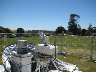
Francis Pierron, a research engineer at the CNRS and the Côte d’Azur Observatory, is the project leader. Returning from Tasmania two weeks ago, he describes the progress represented by the installation. “This small, entirely original laser station in the world was developed in the laboratories of Grasse and regularly improved over ten years. It still weighs a few hundred kilos, but that’s nothing compared to others on the planet, weighing between ten to fifteen tons, and which must be installed in buildings. Provided that the ground is somewhat prepared, our station can be installed and then put into operation in just a few days.”
Laser technology allows for the precise measurement of the distance of an artificial satellite in orbit around the Earth. “Retroreflectors installed on the satellite reflect laser pulses emitted from the ground station. We time the round trip of this laser beam to obtain the distance with millimeter precision, and thus calibrate the satellite by comparing these measurements to those taken by the onboard radar.” This is where things get complicated: “The Jason satellite orbits the Earth at a speed of seven kilometers per second. It enters the field of the station three to four times a day, for a period of about ten minutes. We must be able to direct our laser at the satellite in this time window. To follow it with very high precision throughout its passage and acquire several hundred measurements from its rise to its set.”
Observing the effects of climate change through rising sea levels
For five months, this equipment will therefore contribute to measuring the sea level of the Tasman Sea, located between this island and Australia. “Then, the station will return to Corsica. But the collaboration with the teams in Hobart continues. The exploitation of the measurements will last several years,” declares Francis Pierron. Until now, Ajaccio was the only calibration site in the Northern Hemisphere. The move to another site will improve measurements. Why was Tasmania chosen? Its geographical location in relation to Australia and configuration is about the same as between France and Corsica. Indeed, scientific accuracy requires conducting these campaigns in geographically distant and “uncorrelated” areas.
The use of the laser associated with the oceanographic satellite Jason allows the measurement of ocean heights to within a few millimeters, and even those of waves. Today, sea levels on the surface of the planet rise by an average of 3.5 millimeters per year. “For now, and on a human time scale, it does not seem worrying. But there is concern that this figure may increase in the coming years,” warns Francis Pierron. “With climate change, we expect the melting of glaciers to accelerate. If sea levels rise by a meter in the next century, the situation would become critical even in France for the Camargue. Not to mention Asian countries where many populations live on coastal areas affected.”


